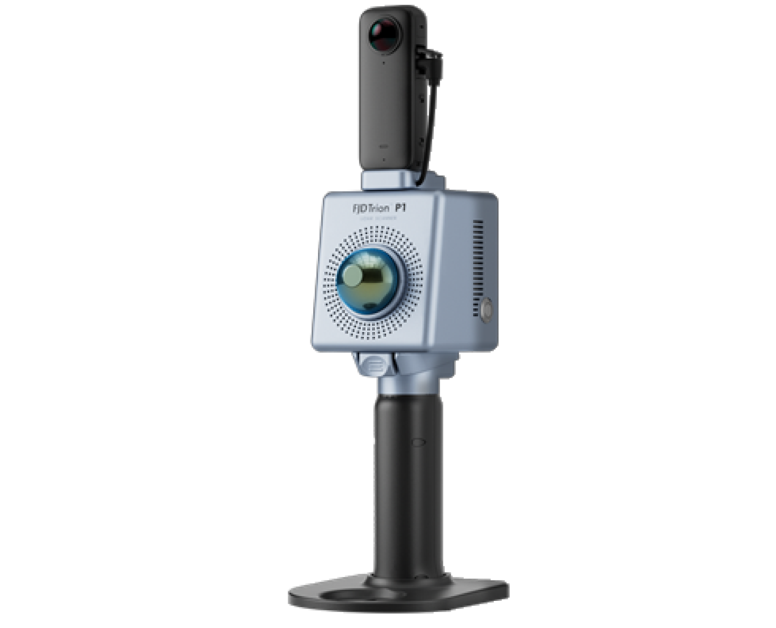
FJD Trion S2
The FJD Trion S2 LIDAR Scanner boasts advanced VIO and SLAM algorithms for generating high-quality and reliable point clouds. Supporting over 8000 coordinate systems, the S2 eliminates the need for time-consuming manual coordinate conversions. By integrating with FJD Trion Scan and Model software and utilizing practical accessories like stabilizing vest, drone mount, car mount, and robot dog mount, the S2 enhances data capturing and processing efficiency for outdoor surveying projects.
Capture point clouds in all directions even in hard-to-reach areas with practical accessories, including stabilizing vest, extension pole, drone, robot dog, and rolling suitcase. You can just go and scan anytime, anywhere.
- AVAILABILITY: AVAILABLE
- Inquire Now
| LiDAR S2 Series Specifications | |
|---|---|
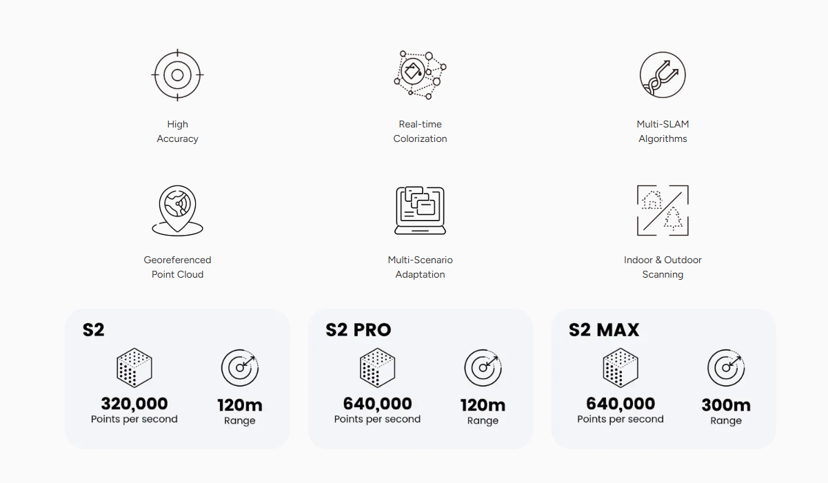
| Range |
S2: 120 m @ 80% reflectivity / 80 m @ 10% reflectivity S2 PRO: 120 m @ 80% reflectivity / 80 m @ 10% reflectivity S2 MAX: 300 m @ 80% reflectivity / 80 m @ 10% reflectivity |
| Channels |
S2: 16 S2 PRO: 32 S2 MAX: 32 |
| Points Per Second |
S2: 320,000 pts/s S2 PRO: 640,000 pts/s S2 MAX: 640,000 pts/s |
| Field of View (FOV) | 360° × 270° |
| Safety Level | Class 1 / 905 nm, eye safe |
| System Parameters | |
|---|---|
| Relative Accuracy | 1 cm |
| Absolute Accuracy | 3 cm |
| Weight | 1.8 kg (Excluding battery, external camera, and RTK module) |
| Battery Life | 3 h (with 1 set of 2 batteries) |
| Storage | 512 GB (1 TB expandable) |
| Operating Temperature | -20℃ to 50℃ |
| Power Consumption | 25 W |
| Dimensions | 107 × 118 × 398 mm (including base and battery) |
| Data Export | Wi-Fi, USB Type-C, USB Flash Disk |
| Point Cloud Format | .las / .ply / .pts / .e57 |
| Power Supply | 10.8 V, 3 A |
| Camera | |
| Resolution | 2 × 12 MP |
| FOV | 200° |
| Visual SLAM | Support |
| Image Export | Support |
| Image Format | .jpg |
| GNSS | |
| Satellite Constellation |
BDS: B1I / B2I / B3I / B1C / B2a / B2b GPS: L1 C/A / L1C / L2P (Y) / L2C / L5 GLONASS: G1 / G2 / G3 Galileo: E1 / E5a / E5b / E6 QZSS: L1C/A / L1C / L2C / L5 (IRNSS and SBAS support by firmware upgrade) |
| RTK Accuracy | H: 8 mm + 1 ppm RMS / V: 15 mm + 1 ppm RMS |
| PPK | Support |
| Brochure FJD Trion S2 | Download |
|---|