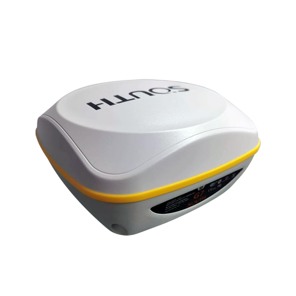
G7
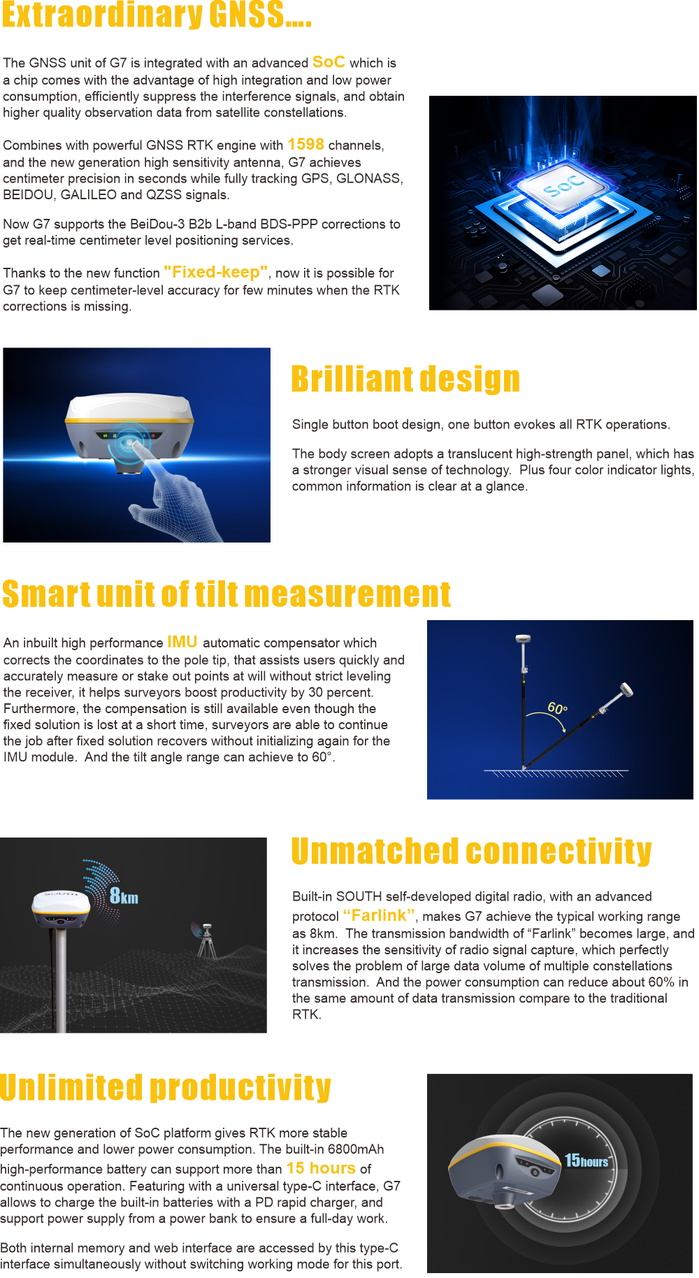
An inbuilt high performance IMU automatic compensator which corrects the coordinates to the pole tip, that assists users quickly and accurately measure or stake out points at will without strict leveling the receiver, it helps surveyors boost productivity by 30 percent. Furthermore, the compensation is still available even though the fixed solution is lost at a short time, surveyors are able to continue the job after fixed solution recovers without initializing again for the IMU module. And the tilt angle range can achieve to 60°.
The new generation of SoC platform gives RTK more stable performance and lower power consumption. The built-in 6800mAh high-performance battery can support more than 15 hours of continuous operation. Featuring with a universal type-C interface, G7 allows to charge the built-in batteries with a PD rapid charger, and support power supply from a power bank to ensure a full-day work.
- AVAILABILITY: AVAILABLE
- Inquire Now
| GPS | L1, L1C, L2C, L2P, L5 |
|---|---|
| GLONASS | L1C/A,L1P,L2C/A,L2P,L3 |
| BDS | BDS-2: B1I, B2I, B3I BDS-3: B1I, B3I, B1C, B2a, B2b* |
| GALILEO | E1, E5A, E5B, E6C, AltBOC* |
| SBAS(WAAS/MSAS/EGNOS/GAGAN) | L1* |
| IRNSS | L5* |
| QZSS | L1, L2C, L5* |
| MSS L-Band | BDS-PPP |
| Positioning output rate | 1Hz~20Hz |
| Initialization time | < 10s |
| Initialization reliability | > 99.99% |
| Code differential GNSS positioning | Horizontal: 0.25 m + 1 ppm RMS Vertical: 0.50 m + 1 ppm RMS |
| Static(long observations) | Horizontal: 2.5 mm + 1 ppm RMS Vertical: 3 mm + 0.4 ppm RMS |
| Static | Horizontal: 2.5 mm + 0.5 ppm RMS Vertical: 3.5 mm + 0.5 ppm RMS |
| Rapid static | Horizontal: 2.5 mm + 0.5 ppm RMS Vertical: 5 mm + 0.5 ppm RMS |
| PPK | Horizontal: 3 mm + 1 ppm RMS Vertical: 5 mm + 1 ppm RMS |
| RTK(UHF) | Horizontal: 8 mm + 1 ppm RMS Vertical: 15 mm + 1 ppm RMS |
| RTK(NTRIP) | Horizontal: 8 mm + 0.5 ppm RMS Vertical: 15 mm + 0.5 ppm RMS |
| RTK initialization time | 2 ~ 8s |
| SBAS positioning | Typically <5m 3DRMS |
| BANDA-L | Horizontal: 5-10cm (5-30min) Vertical: 10-30cm (5-30min) |
| IMU | Less than 10mm + 0.7 mm/° tilt to 30° |
| IMU tilt angle | 0° ~ 60° |
| Operaing system | Linux |
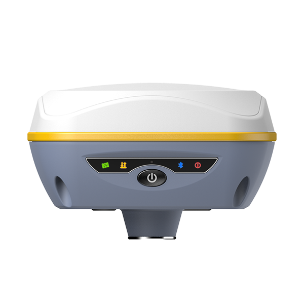
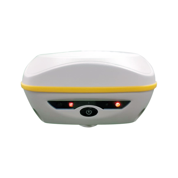
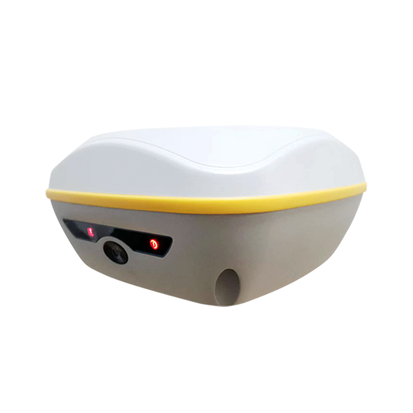
| Buttons | Single button |
| Indicators | 4 LED indicators(satellite, Datalink, Bluetooth, Power) |
| Web interaction | With the access of the internal web interface management via WiFi or USB connection, users are able to monitor the receiver status and change the configurations freely |
| Voice guidance | It provides status and operation voice guidance, and supports Chinese/English/Korean/Spanish/Portuguese/Russian/Turkish |
| Secondary development | Provides secondary development package, and opens the OpenSIC observation data format and interaction interface definition |
| Cloud service | The powerful cloud platform provides online services like remote manage, firmware update, online register and etc. |
| Dimension | 135mm(W) ×135mm(L) × 84.75mm(H) |
| Weight | 970g (battery included) |
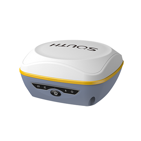
| Material | Magnesium aluminum alloy shell |
| Operating temperature | -25°C~+65°C |
| Storag temperature | -40°C~+80°C |
| Humidity | 100% Non-condensing |
| Waterproof/Dustproof | IP67 standard, protected from long time immersion to depth of 1m IP67 standard, fully protected against blowing dust |
| Shock and vibration | Withstand 2 meters pole drop onto the cement ground naturally MIL-STD 810G |
| Power Supply | 6-28V DC, overvoltage protection |
| Battery | Inbuilt 7.2V 6800mAh rechargeable, Li-ion battery |
| Battery life*1 | 15h (Rover Bluetooth mode) |
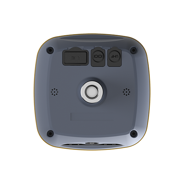
| I/O port | 5-PIN LEMO external power port + RS232 Type-C interface (charge, OTG, data transfer to PC or phone, Ethernet) 1 UHF antenna interface |
| Internal UHF | 2W radio, receive and transmit, radio router and radio repeater |
| Frequency Range | 410-470MHz |
| Communication Protocol | Farlink, Trimtalk450s, SOUTH, HUACE, Hi-target, Satel |
| Communication range | Typically 8km with Farlink protocol |
| Bluetooth | Bluetooth 3.0/4.1 standard, Bluetooth 2.1 + EDR |
| NFC Communication | Realizing close range (shorter than 10cm) automatic pair between receiver and controller (controller requires NFC wireless communication module else) |
| Modem | 802.11 b/g standard |
| WIFI hotspot | Receiver broadcasts its hotspot form web UI accessing with any mobile terminals |
| WIFI data link | Receiver can transmit and receive correction data stream via WiFi datalink |
| Storage | 4GB SSD internal storage standard, extendable up to 64GB Automatic cycle storage (The earliest data files will be removed automatically while the memory is not enough) Support external USB storage The customizable sample interval is up to 20Hz |
| Data transmission | Plug and play mode of USB data transmission Supports FTP/HTTP data download |
| Data format | Static data format: STH, Rinex2.01, Rinex3.02 and etc. Differential data format: RTCM 2.1, RTCM 2.3, RTCM 3.0, RTCM 3.1, RTCM 3.2 GPS output data format: NMEA 0183, PJK plane coordinate, Binary code Network model support: VRS, FKP, MAC, fully support NTRIP protocol |
| Electronic bubble | Controller software can display electronic bubble, checking leveling status of the carbon pole in real-time |
| IMU | Built-in IMU module, calibration-free and immue to magnetic interference |
| Thermometer | Built-in thermometer sensor, adopting intelligent temperature control technology, monitoring and adjusting the receiver temperature |
| G7 Brochure | Download |
|---|